 Previous Article
 Next Article
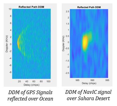
Delay Doppler Maps of Reflections. Photo: ISRO
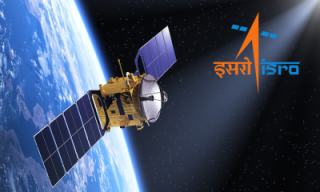
BEGALURU (PTI): ISRO has said that the GNSS-Reflectometry (GNSS-R) instrument that represents "a new mode of remote sensing" on the EOS-08 satellite has commenced operations.
The instrument, developed by the Space Applications Centre (SAC-ISRO), is India's first space-borne precision receiver, according to ISRO.
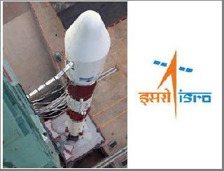
The space agency on August 16 had successfully launched the Earth Observation Satellite EOS-08 on board the third developmental flight of small satellite launch vehicle SSLV-D3.
GNSS-R commenced operations on August 18.
The raw data is being processed at the National Remote Sensing Centre (NRSC-ISRO) in Shadnagar, Hyderabad, using algorithms and data processing software developed by the Space Applications Centre (SAC-ISRO), Ahmedabad, and multiple levels of data products have been successfully generated, it said.
Noting that signals from Global and Regional Navigation Satellite Systems (GNSS/RNSS), such as GPS and NavIC, are reflected off various Earth surfaces, including oceans, agricultural lands, and river bodies, ISRO on Wednesday said, these reflected signals are collected by a precision receiver onboard the satellite as it orbits the Earth at an altitude of 475 km.
This measurement system operates without dedicated transmitters and is shallow in resource consumption-requiring minimal size, weight, and power, it said. Additionally, it can scale up as a constellation of receivers for faster coverage, making this innovative remote-sensing mode highly useful.
Noting that GNSS-R collects ground-reflected GNSS signals and measures their power and other signal characteristics, ISRO said, these measurements are used to derive scientific information about the regions covered by the receiver, including soil moisture, surface inundation, and ocean surface wind and wave measurements.
The instrument provides a resolution of 15 km x 15 km over oceans and better than 1 km x 1 km over land, it said.
Delay-Doppler Maps (DDMs) are the primary outputs from GNSS-R raw data processing. These DDMs are used to derive parameters such as reflectivity and Normalized Bistatic Radar Cross-Section (NBRCS), which are then used for the retrieval of various scientific parameters, it said.
According to ISRO, all the science products are generated at SAC-ISRO using in-house developed algorithms. The first land data was collected over the Sahara Desert (North Africa) using a high-resolution mode of 1 km, which is significantly better than that of contemporary CYGNSS sensors.
This data was processed to retrieve soil moisture at high resolution, and the results were found to be within the expected range. Another high-resolution land dataset was acquired over the Amazon Rainforest on August 21. This data has been used to generate surface inundation masks along the specular reflection track, showing sensitivity even towards sub-kilometer river widths, it said.
The first ocean data was collected on August 19, over a region of the Pacific Ocean, it further said, adding that this data was processed for the retrieval of wind speed and significant wave height, with all obtained values falling within the expected ranges.
"While calibration and validation are ongoing, these results demonstrate the immense potential of this instrument for various scientific studies and applications," ISRO added.


The Indian Air Force, in its flight trials evaluation report submitted before the Defence Ministry l..
view articleAn insight into the Medium Multi-Role Combat Aircraft competition...
view articleSky enthusiasts can now spot the International Space Station (ISS) commanded by Indian-American astr..
view article