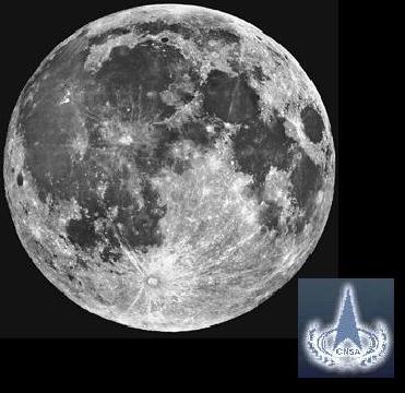
China completes 3D moon map using image data obtained by a camera on the country's first lunar probe, the Chang'e 1
BEIJING (AFP/PTI): China has completed a high-resolution, three-dimensional map of the entire surface of the moon, state media reported, in an important step towards a future lunar landing.
After putting its first man into space in 2003, only the third nation to do so, China is aiming to launch an unmanned rover on the moon's surface by 2012 and a manned mission to the moon by around 2020.
The map was made using image data obtained by a camera on China's first lunar probe, the Chang'e 1 launched in October 2007, the official Xinhua news agency said Monday.
Quoting Liu Xianlin, an academic at the Chinese Academy of Surveying and Mapping, the report said the map would help scientists study the features of the moon's surface and deepen understanding of lunar geology and its evolution.
Chen Yongqi, a professor in the department of land surveying and geo-informatics at Hong Kong Polytechnic University, said the map was an important step towards a future lunar landing.
"It is an important stage for the later lunar landing, a selection of the landing site, and to better understand the lunar structure," he told AFP.
"Another objective is to understand the soil of the lunar surface and mineral distribution."
 Previous Article
 Next Article




The Indian Air Force, in its flight trials evaluation report submitted before the Defence Ministry l..
view articleAn insight into the Medium Multi-Role Combat Aircraft competition...
view articleSky enthusiasts can now spot the International Space Station (ISS) commanded by Indian-American astr..
view article