 Previous Article
 Next Article
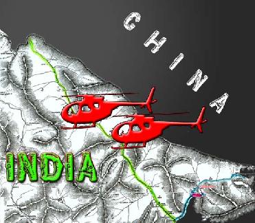
A file photo
LEH (PTI): After helicopter incursions into Indian airspace, the Chinese Army has brazenly violated the International Border in Ladakh region and painted boulders and rocks in the area red.
The Chinese troops entered nearly 1.5 kilometres into the Indian territory near Mount Gya, recognised as International border by India and China, and painted the boulders and rocks with red spray paint, official sources said.
The incursions were reported from the area, generally referred in the Chumar sector in east of Leh, and painted �China� in Cantonese with Red spray paint all over the boulders and rocks, they said.
The 22,420 ft Mount Gya, also known as �fair princess of snow� by Army is located at the tri-junction of Ladakh in Jammu and Kashmir, Spiti in Himachal Pradesh, and Tibet. Its boundary was marked during the British era and regarded as International Border by the two countries.
The border patrol discovered the red paint markings on various rocks and boulders along the Zulung La (pass) on July 31 and the Chinese had entered into the area and written �China� and �China� all over the place, the sources said.
When asked to comment on the issue, an Army spokesperson declined to answer any queries regarding this saying it was an operational matter.
Though the spokesperson refused to answer further questions, senior Army officials said the issue was being downplayed as three of its Generals were currently in Beijing and Lhasa under an exchange programme.
This incident was viewed with seriousness by the officials as the Chinese have made foray into these areas for the first time since independence and sprayed the area with red marking as deep as 1.5 to 1.7 kilometres of the Indian territory.
The border forces talked to the locals located along the border in Ladakh and Spiti from where they came to know about the incursions by the People's Liberation Army of China in the area.
River Pareechu, which runs through Himachal Pradesh, has been a headache as frequent floods enter Tibet from this region only.
Before this, Chinese helicopters had violated the Indian air space along the Line of Actual Control in Chumar region only in June and also Helli-dropped some expired food.
Reacting to this, the Army spokesperson had said there was a report of a helicopter flying in the area south of Chumar, where India and China have differences in perception on the Line of Actual Control. It was reported by grazers.
India and China have been engaged in talks over the Line of Actual Control and had exchanged maps in 2002. In the western sector (East Jammu and Kashmir), the Samar Lungpa area, between the Karakoram Pass and the Chipchap river, is contentious, with Chinese maps showing the LAC to be south of the Samar Lungpa.
This is the northernmost part of the border, far to the north of Leh. But while the Indo-Tibetan Border Police operates north of the line the Chinese claim to be the border, they remain south of the Lungpa.
South of the Chipchap River are the Trig Heights, comprising Points 5495 and 5459.
Chinese troops frequently enter the area and in fact, they have a name for Point 5459; Manshen Hill. The area, south-east of Trig Heights, called Depsang Ridge is also contentious. Differences were found when Chinese small-scale maps were interposed on large-scaled Indian ones.


The Indian Air Force, in its flight trials evaluation report submitted before the Defence Ministry l..
view articleAn insight into the Medium Multi-Role Combat Aircraft competition...
view articleSky enthusiasts can now spot the International Space Station (ISS) commanded by Indian-American astr..
view article